Garmin Introduces Next-Gen ECHOMAP Ultra 2 Series
Also posted to:
A Light to Steer By
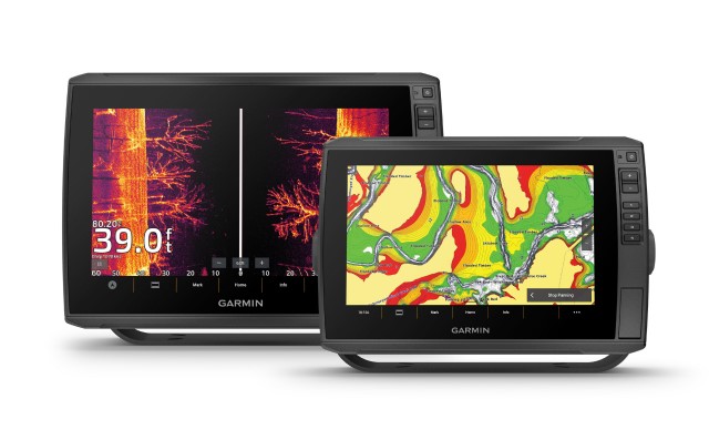
Garmin announced the ECHOMAP Ultra 2 chartplotter series designed with advanced features for inland and nearshore anglers. Offering a 10- or 12-inch sunlight-readable touchscreen with keyed assist, they put UHD scanning sonar, preloaded Garmin Navionics+ mapping with an included 1-year subscription for daily updates, wireless networking capabilities and more at an angler’s fingertips.
Combining power and functionality, the ECHOMAP Ultra 2 series will meet the demands of today’s angler with exciting new features, including:
Wireless Networking: Share sonar, waypoints and routes with another ECHOMAP Ultra 2 or ECHOMAP UHD2 chartplotter on the boat, reducing the need to drill extra holes in the boat, while also keeping the deck space free from the clutter of extra cables.
Position Accuracy: Multi-band GPS technology with fast 10Hz updates not only provides improved position accuracy, which can benefit anglers particularly in areas like under bridges, along bluffs or in coves with tree cover.
Screen Recording: Using the ActiveCaptain app, capture what’s on the chartplotter screen, including fish catches seen on LiveScope sonar (if installed) to share via text or social media.
Ease of Use: Featuring a modernized operating system with updated graphics, menus and a new homepage, anglers will appreciate how intuitive and easy-to-use the Ultra 2 series is.
For nearly photographic images of fish and structure, the Ultra 2 chartplotters are available bundled with a GT56UHD all-in-one transducer that provides Garmin CHIRP traditional sonar and Ultra High-Definition ClearVü and SideVü scanning images of what’s below and to the sides of the boat. The new series also supports the full lineup of Garmin’s award-winning LiveScope live-scanning sonar.
Available in two sizes, the ECHOMAP Ultra 2 106sv with a 10-inch display and ECHOMAP Ultra 2 126sv with a 12-inch display, the new series offers unparalleled mapping coverage and detail for both coastal and inland waters with built-in Garmin Navionics+. In addition to the included 1-year subscription for daily updates, Garmin Navionics+ also offers depth range shading and Auto Guidance+ for faster route calculation speeds of suggested pathways. Anglers can also upgrade to Garmin Navionics Vision+ premium mapping, which offers high-resolution relief shading and more. To instantly create personalized fishing maps, the series also includes built-in Quickdraw Contours mapping software to deliver HD maps with 1-foot contours on any body of water.
When wirelessly integrated with a Garmin Force trolling motor, anglers can create routes, patterns and tracks for the trolling motor to follow while they fish. From the chartplotter screen, they can also control speed, check battery life and more.
COMPANY DETAILS |

|
|
Company |
Garmin |
|
Website |
|
|
Connect |
   
|
|
|
|
|
Address |
1200 E. 151st St. |
|
Olathe, KS 66062-3426 |
ABOUT Garmin®
Garmin International makes products that are engineered on the inside for life on the outside. They do this so their customers can make the most of the time they spend pursuing their passions. With more than 11,500 associates in 60 offices around the world, they bring GPS navigation and wearable technology to the automotive, aviation, marine, outdoor and fitness markets.